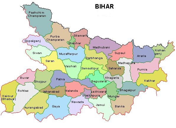
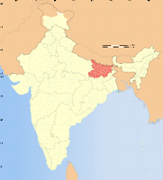
State of Bihar
Capital: Patna
Area: 94,163 sq km
Date of Creation: 15 Aug, 1947 Province: 26 Jan. 1950 state (until 1956: part (A)
Neighbouring States: Jharkhand, Uttar Pradesh, West Bengal. Country: Nepal.
Population: 103,804,637, Males: 54,185,347, Females: 49,619,290, Sex-ration: 916, Density: 1,102, Decadal growth: 25.07%, Literacy: 54.390,254 (Total 63.82%, Male 73.39%, Female 53.33%).
No of Districts: 38, Villages: 39,015, Towns: 130
Legislative Bodies: State Legislature-Bicameral, Assembly Seats: 243, Legis Council: 95, Parliament: Lok Sabha seats: 40(34+6+0), Rajya Sabha Seats: 16
Main Political Parties: BJP-Bharatiya Janata Party, Rashtrya Janata Dal, INC, CPI, BSP, CPI (M), Janata Dal (United), Samajwaadi Party, Lok Jan Shakti Party.
Seat of High Court: Patna.
Chief Languages: Hindi, Urdhu, Bhojpuri, Magadhi, Angika, Maithili.
Major Religions: Hindusim, lslam, Buddhism, Christianity.
Main Towns: Patna, Gaya, Biharsharif, Bhagalpur, Purnia, Muzaffarpur, Bettah, Motihari , Siwan, Munger, Bhagalpur, Araria, Arrah, Chhapra, Sasaram, Buxar, Darbhanga, Raxaul.
Geography:
(a) Rivers: Ganga, Gandak, Burhi Gandak, Son, Saryu (Ghaghara), Kosi, Kamla, Panar, Saura, Lakhandai, Keul, Ghuari, Pun-pun.
(b) Mountains: Mandargiri Hills, Mirzapur, Kharagpur, Rajgir, Bapabar Hills, Kaimur Plateau, Nawada Upland:
(c) Plains North Bihar Plains South Bihar Plains, Motihari, Lower Son, Bettiah, Saran, Sitamarhi, Saharsa, Aaria, Madhubani, Dharmapuri, Katihar, Bhagalpur.
(d) Valmiki N.Park. Forest: 7.1 %.
Economy:
(a) Minerals: llmenite, Kaolin, Limestone, Mice, fuller’s earth,
(b) Industries: cotton spinning mills, sugar mills, jute mills and leather industries:
(c) Agricultural Products: rice, wheat, cash crops like sugarcane, oilseeds, maize and pulses, potato, tobacco and jute.
Transport & Communications:
(a) Road Length: 46107km (in 2001)NH-3734km, SH-3989km
(b) Main Railway Stations: Patna, Gaya,Muzaffarpur, Samastipur, Barauni, Katihar, Siwan
(d) Airport: Patna.
Culture:
(a) Dances: Seraikella


Hajipur is very popular town of Bihar. It should be added in main town section in this page.
ReplyDeleteVery informative blog! Patna is the capital and the most beautiful and developed city of Bihar. You can visit here at Golghar, Agam Kuan, Vasundhara Metro Mall, Folk Art Museum, St Luke's Church, Begu Hajjam's Mosque, Rajendra Smriti Sangrahalaya Museum and Khuda Bakhsh Oriental Library etc. These are the attraction of the city. You can arrive at these destinations by car rentals or taxi services in Patna. You can easy hire a car for local and outstation visit.
ReplyDeletePost a Comment